


Download in PDF format
Climate maps for basic variables such as surface precipitation and wind are provided in PDF format for ease of printing. All figures and numerical data can be downloaded from the page in PNG, EPS or CSV format for each variable.
| element | color 1 | color 2 | black and white |
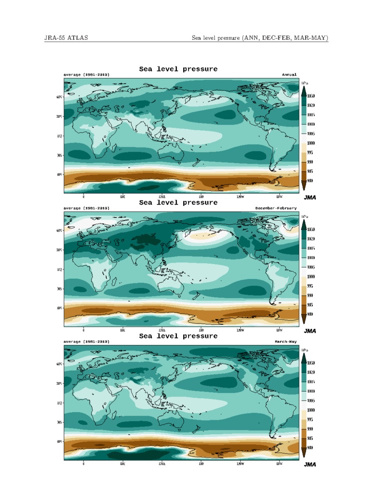
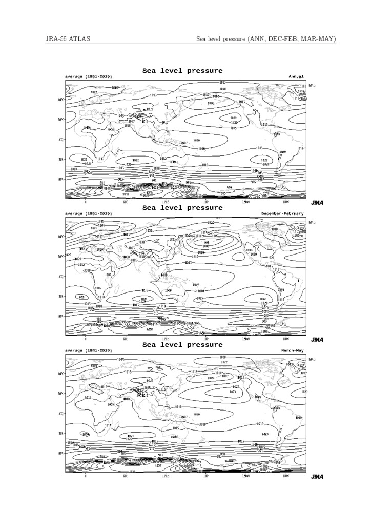
| Sea level pressure | 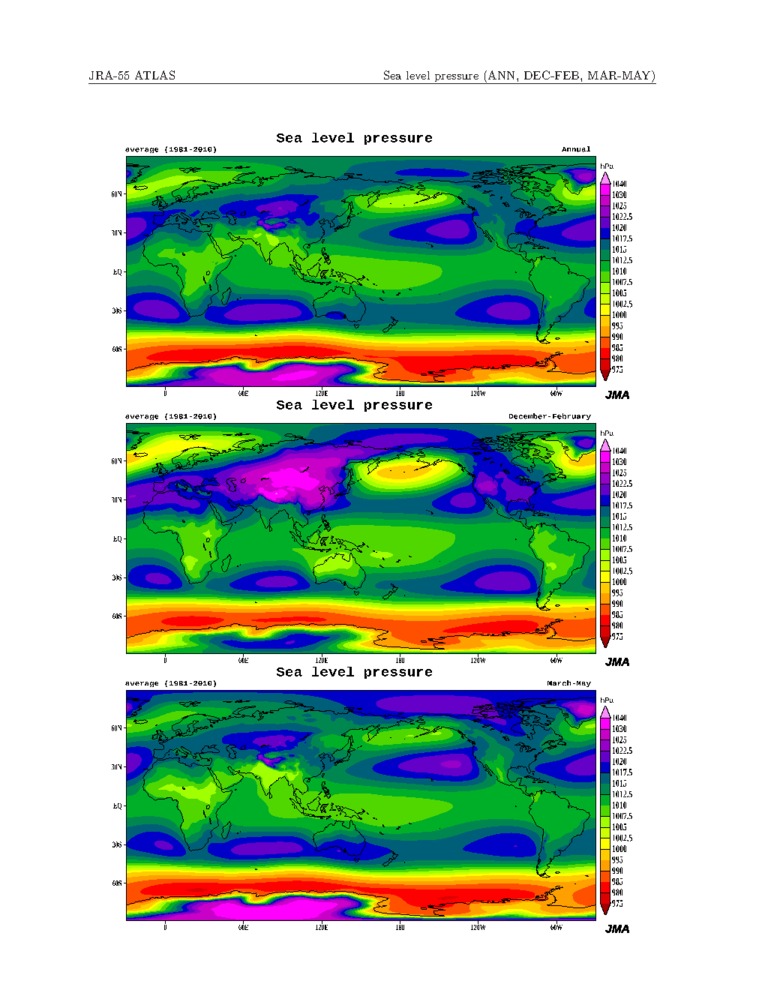 |
 |
 |
|
|
|
|
|
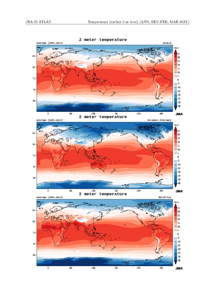
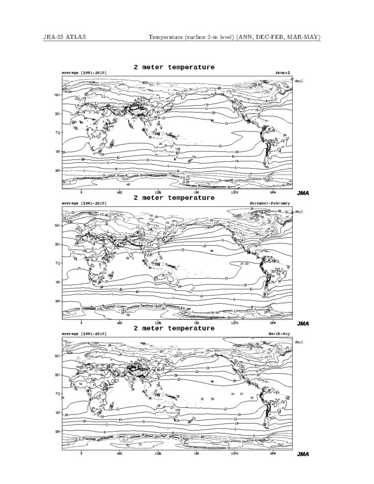
| Temperature (surface 2m level) | 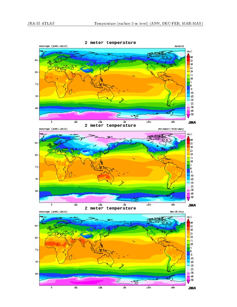 |
 |
 |
|
|
|
|
|
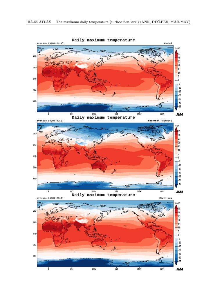
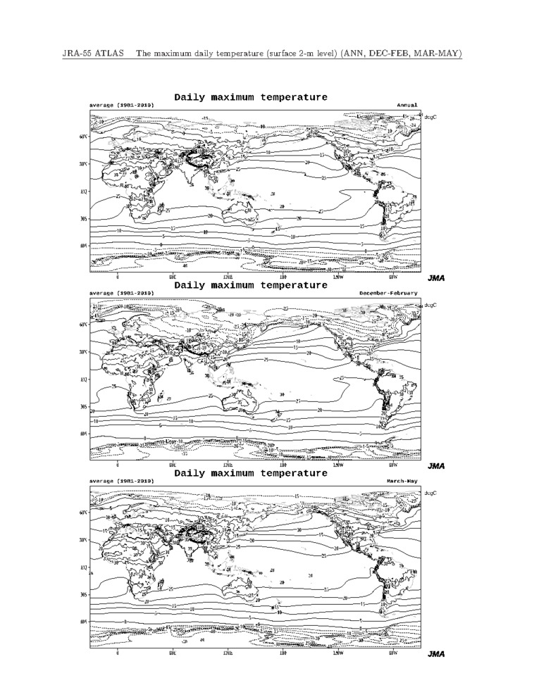
| Maximum daily temperature (surface 2m level) | 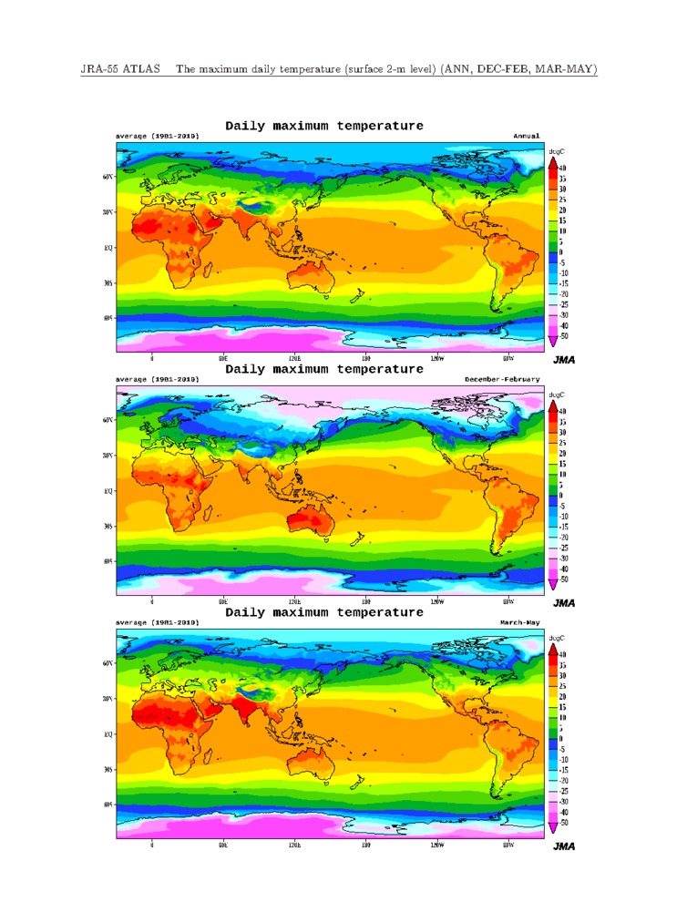 |
 |
 |
|
|
|
|
|
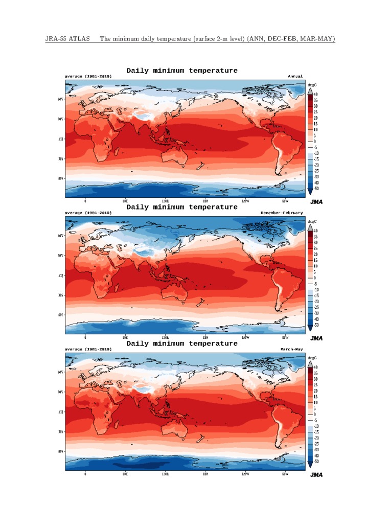
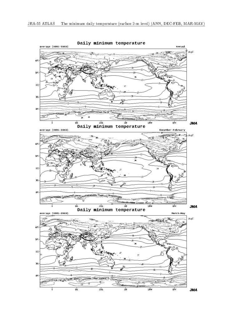
| Minimum daily temperature (surface 2m level) | 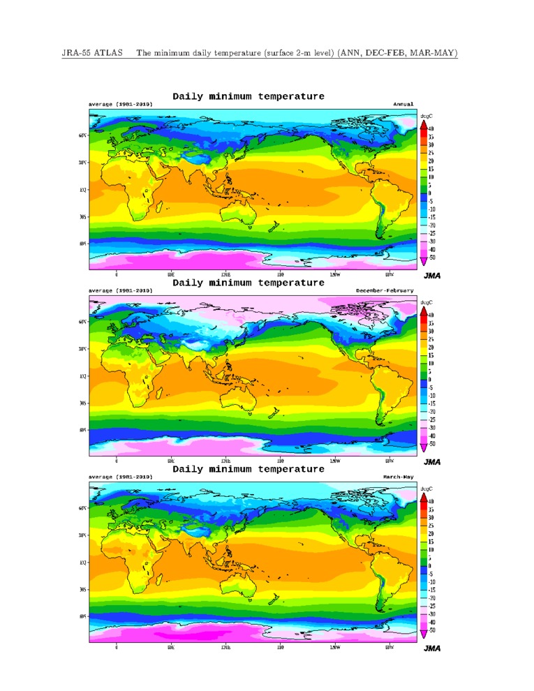 |
 |
 |
|
|
|
|
|
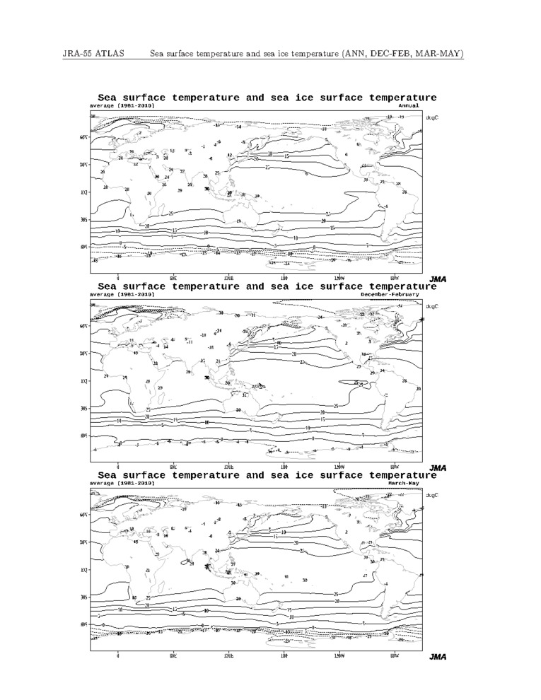
| Sea surface temperature and sea ice | 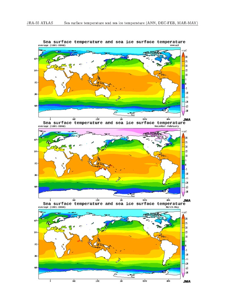 |
 |
 |
|
|
|
|
|
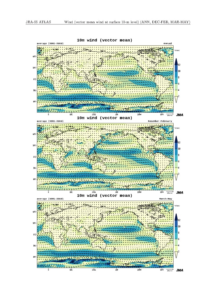
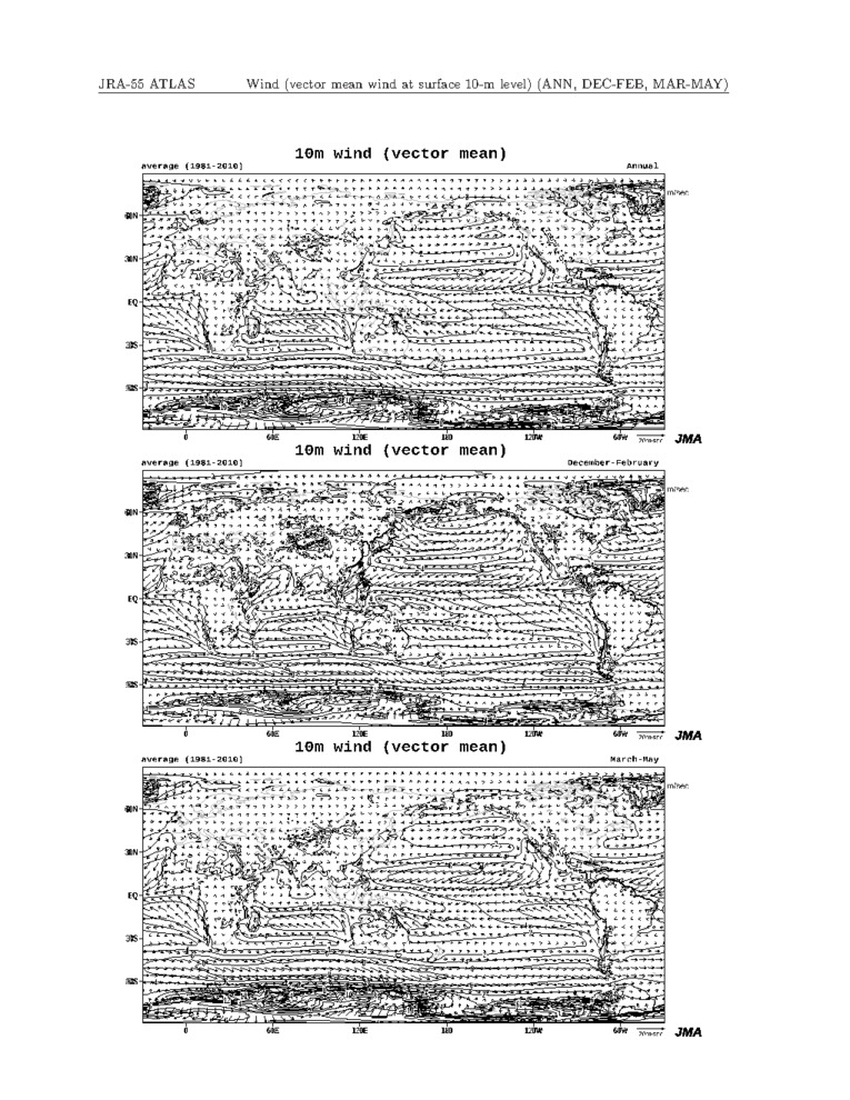
| Wind (vector wind at surface 10m level) |  |
 |
 |
|
|
|
|
|
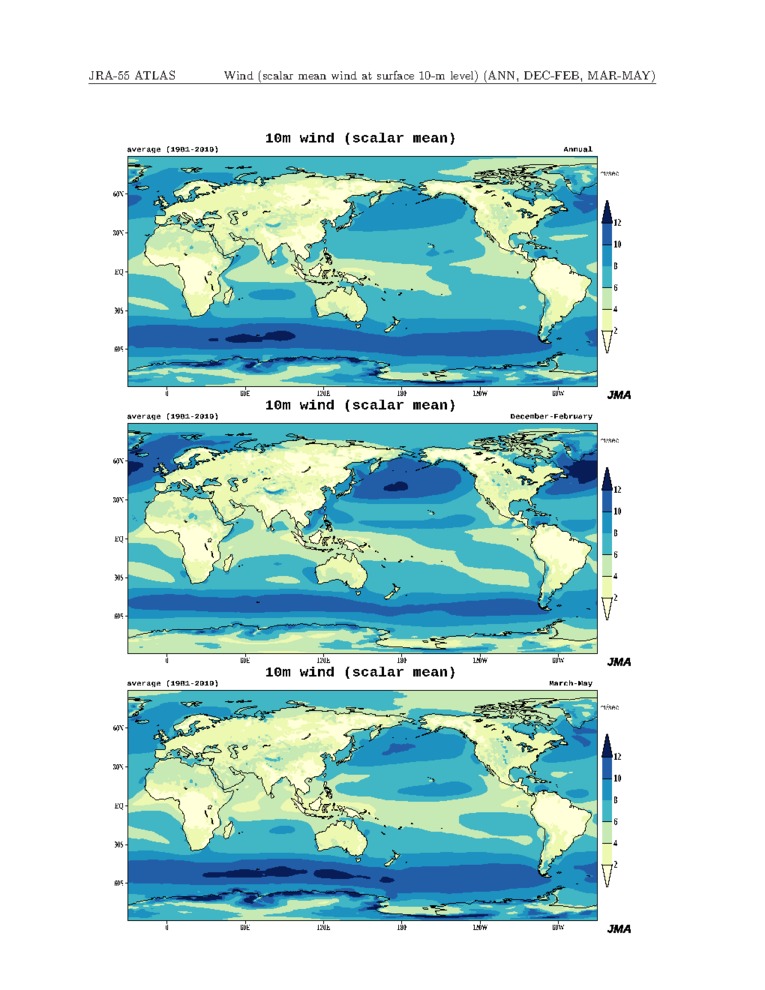
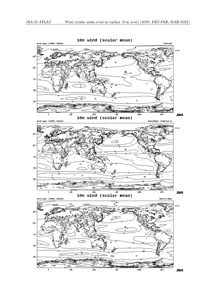
| Wind (scalar wind at surface 10m level) | 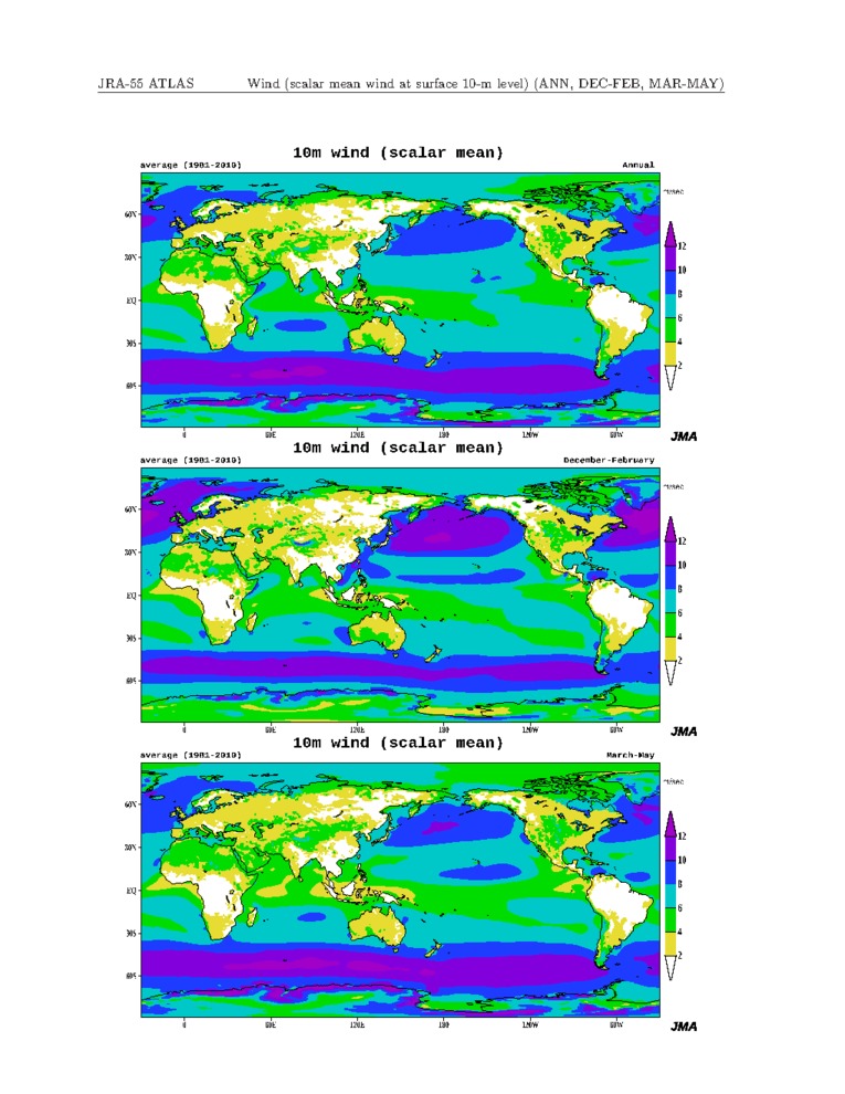 |
 |
 |
|
|
|
|
|
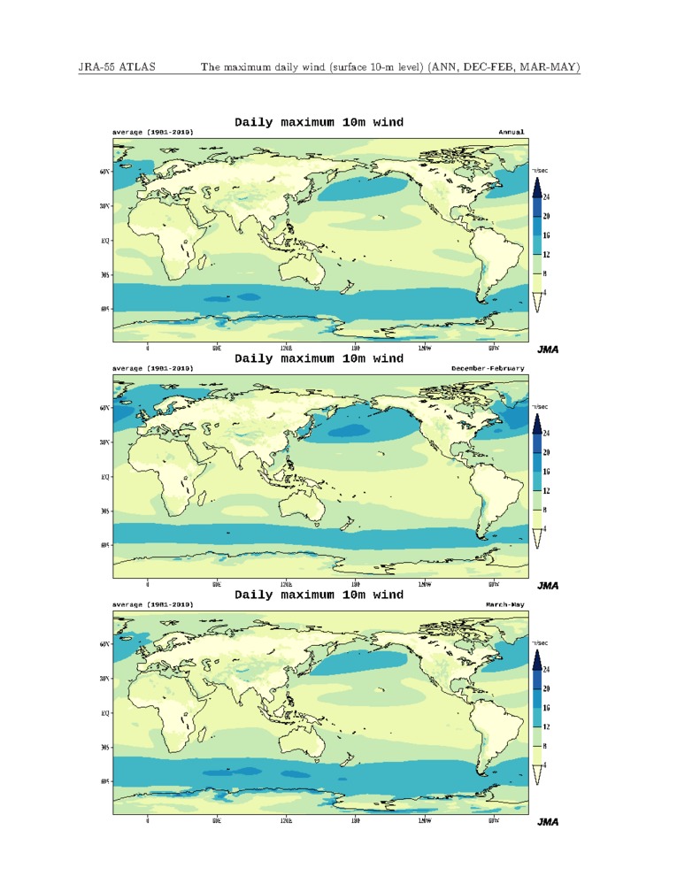
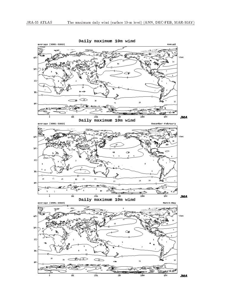
| Daily maximum wind (surface 10m level) | 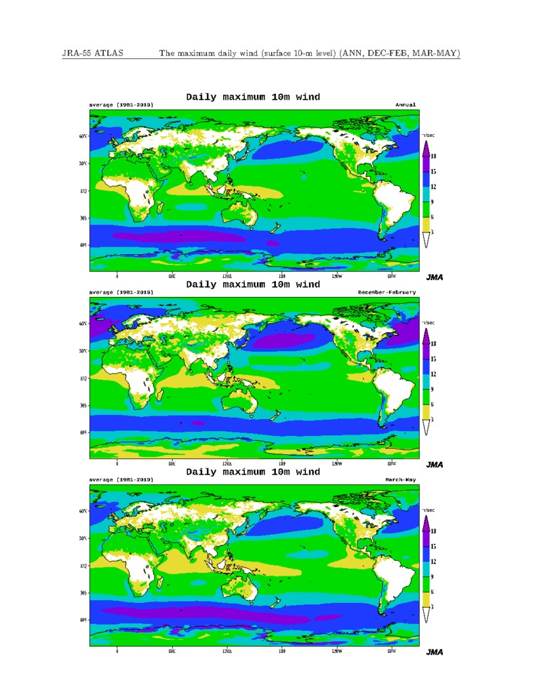 |
 |
 |
|
|
|
|
|
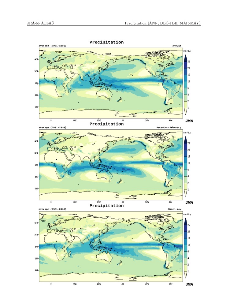
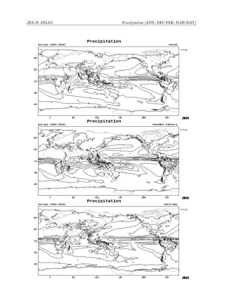
| Precipitation | 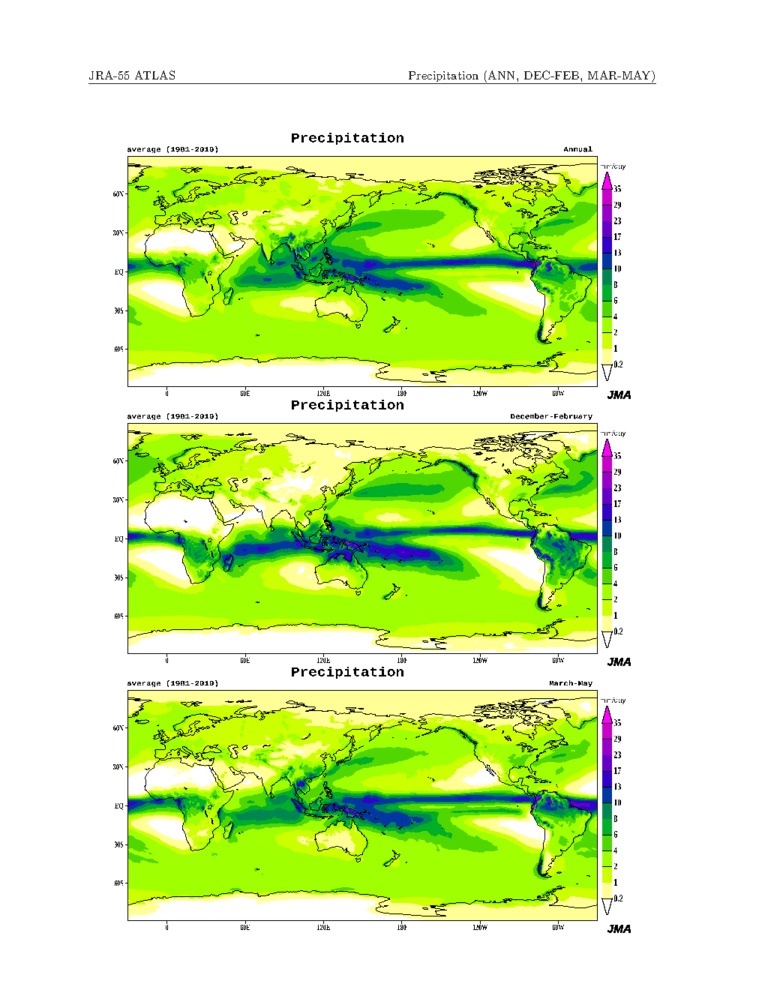 |
 |
 |
|
|
|
|
|
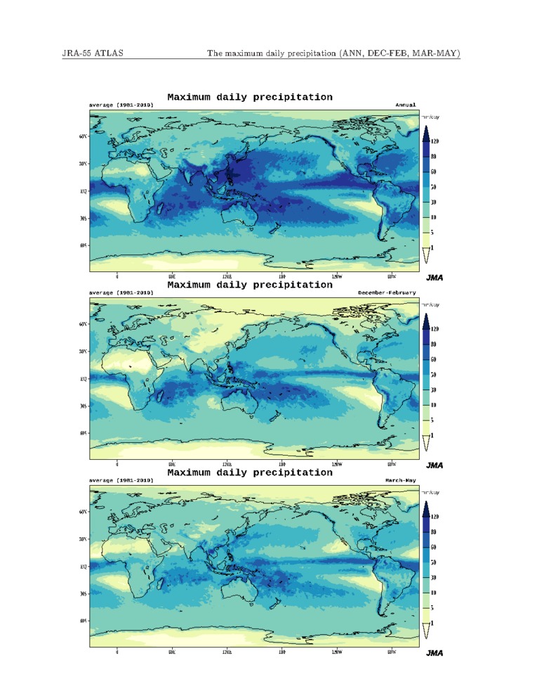
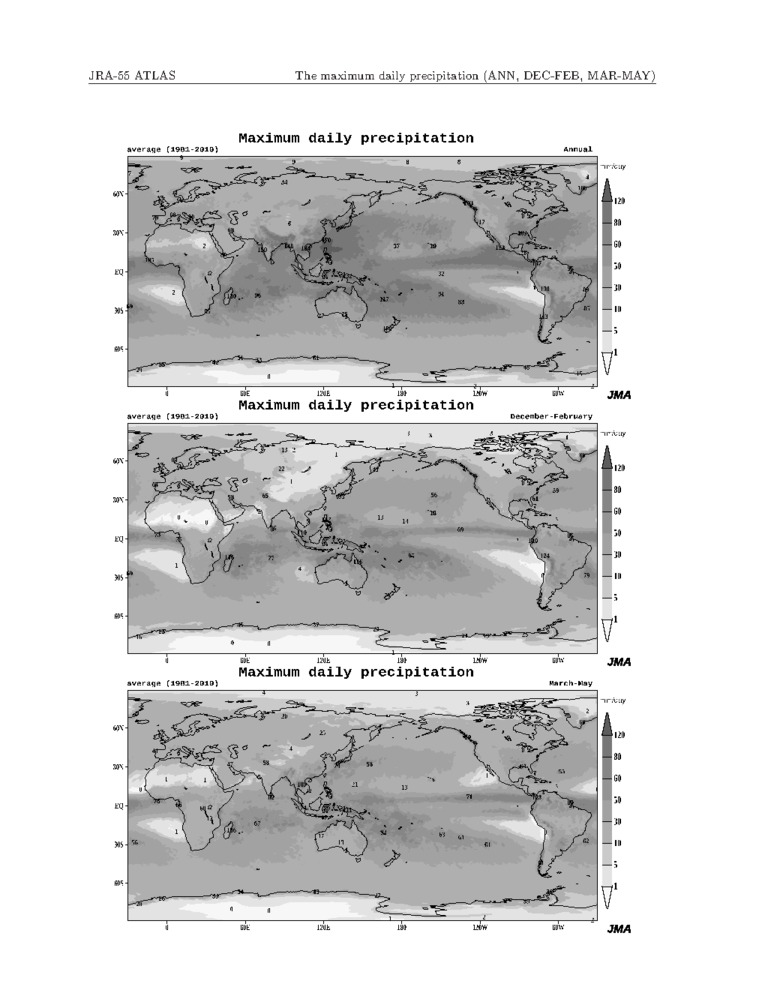
| Maximum daily precipitation | 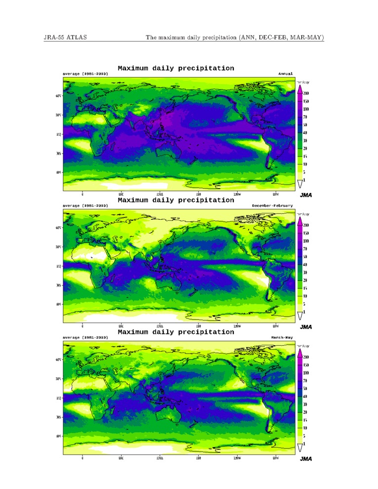 |
 |
 |
|
|
|
|
|
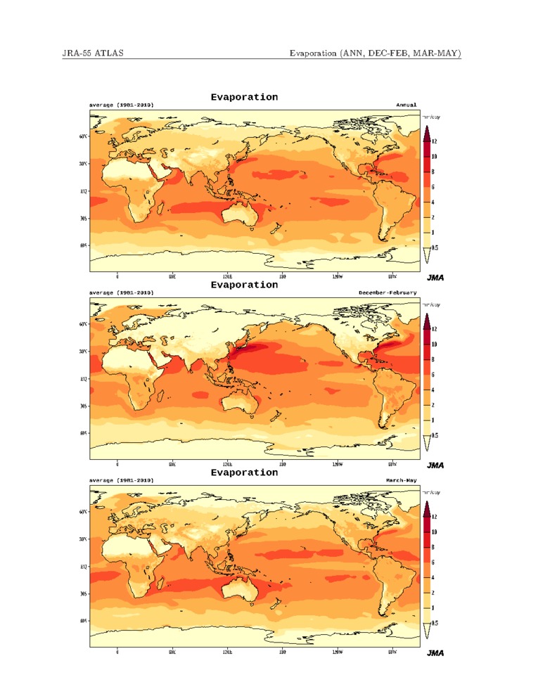
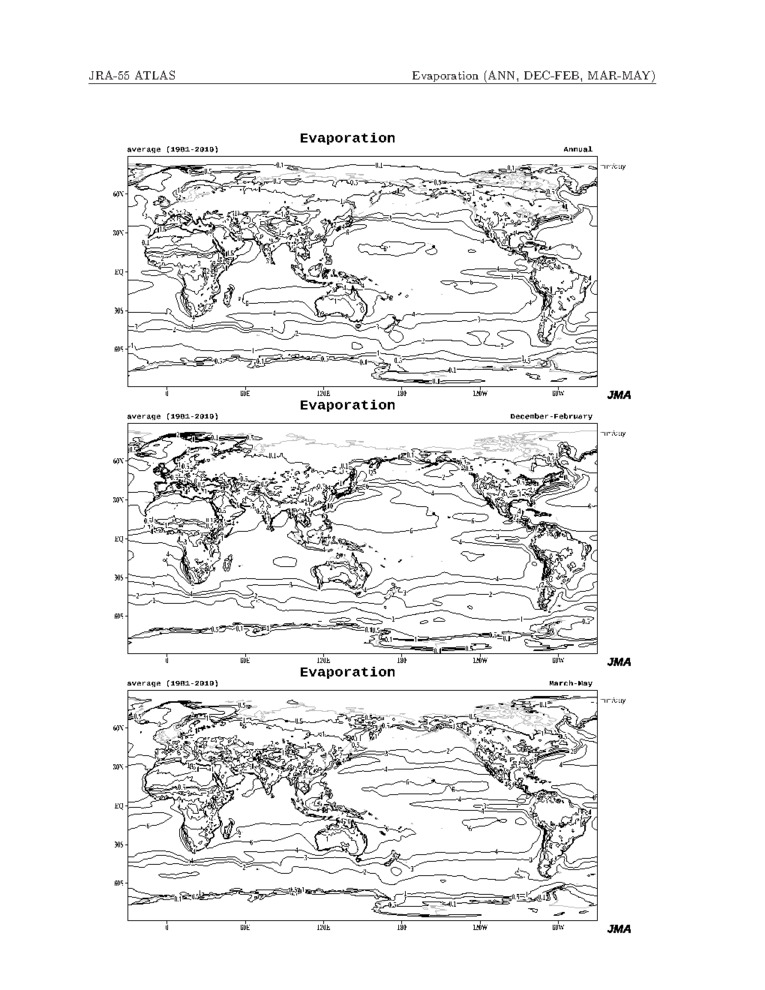
| Evaporation | 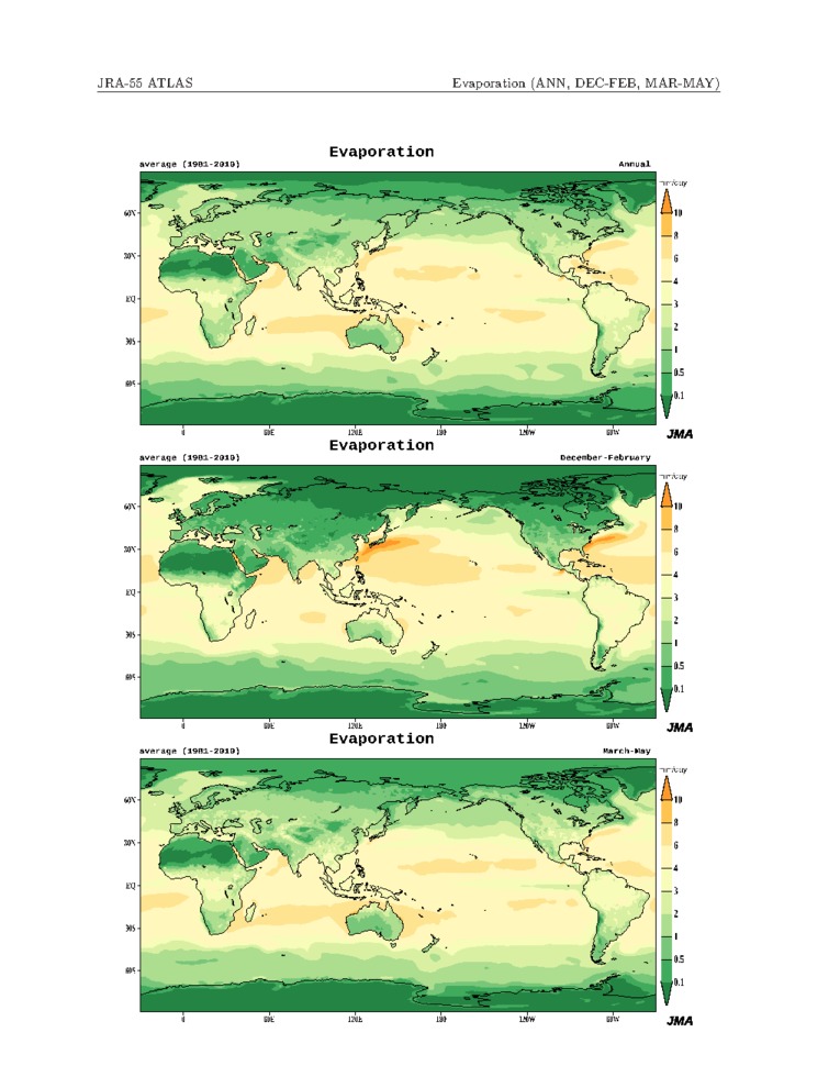 |
 |
 |
|
|
|
|
|
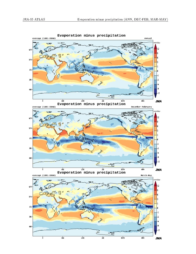
| Evaporation minus precipitation | 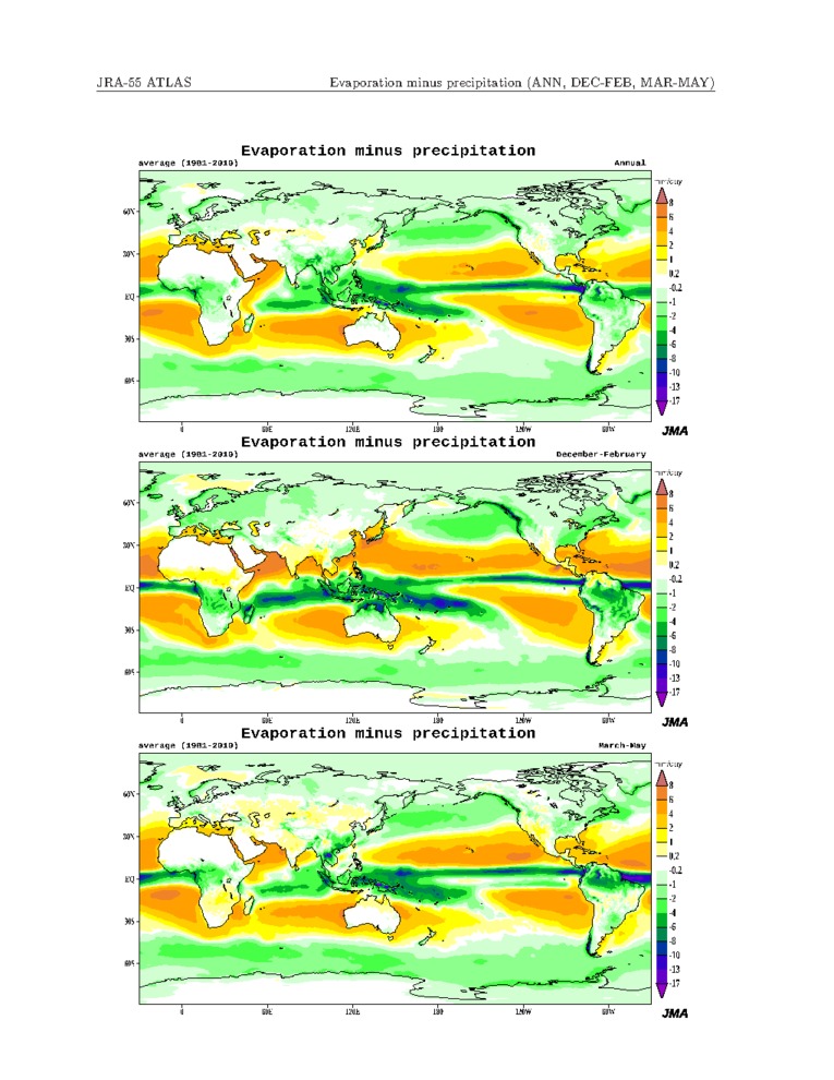 |
 |
 |
|
|
|
|
|
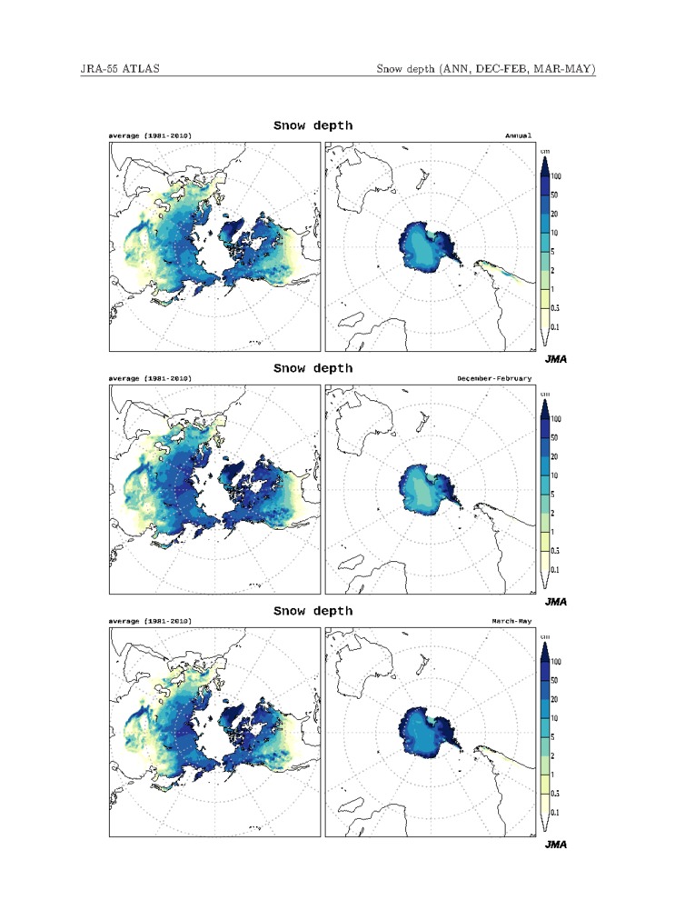
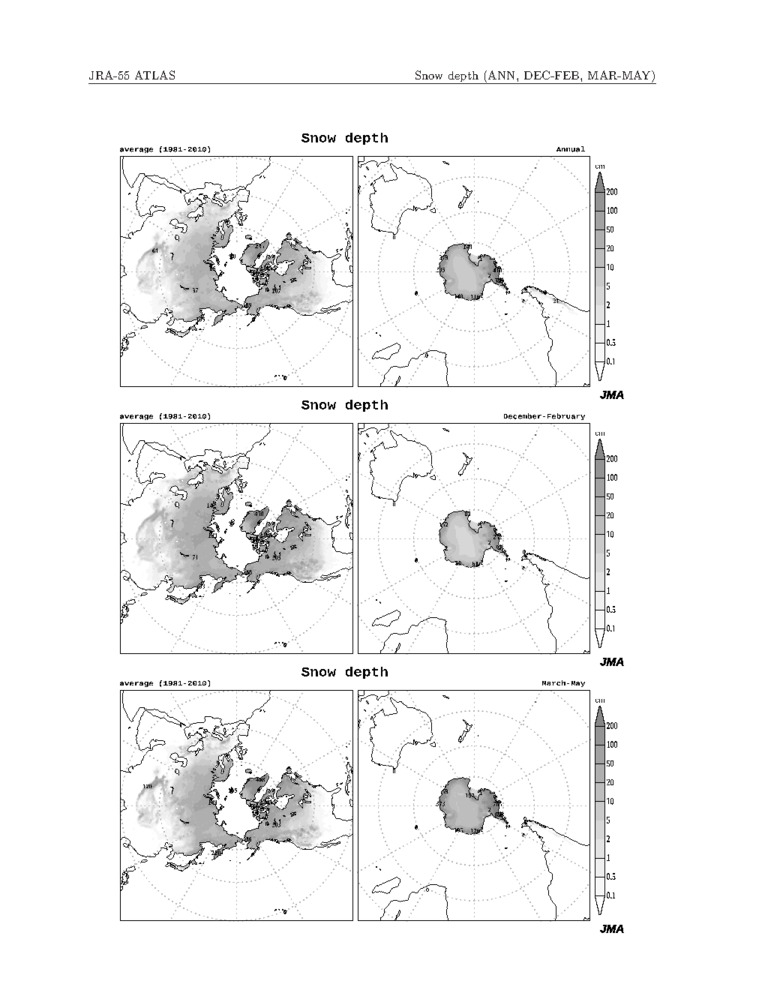
| Snow depth |  |
 |
 |
|
|
|
|