

How to use; JRA-55 Atlas instructions
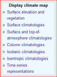
The JRA-55 Atlas provides climate maps for more than 70 meteorological variables in the seven categories listed below "Display climate map" in the right-hand menu.
1. Category Selection
Choose a category from the right-hand menu. First-time users may wish to try "Surface climatology" to start.
|
 |
2. Variable and color selection
After selecting a category, choose a variable, color and vertical level (only for isobaric and isentropic climatologies) from the upper menu ①. Once the figures appear on the screen, choose a month or season using the lower buttons ②.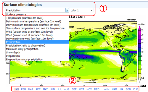
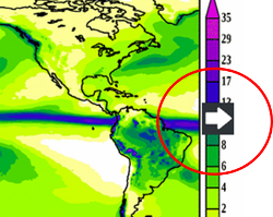
To see seasonal changes, use the left or right keyboard arrow "← →" or click the arrow icon that appears when the cursor is placed over the figure. Each arrow key action or click toggles to the previous or next month/season.
3. Display figure commentary
Detailed commentary for each figure can be displayed in a pop-up window by clicking the "Figure legend" button below the figure.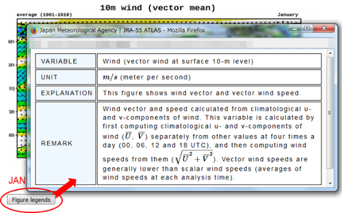
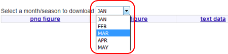
4. Download figure and data file
Climate maps in the JRA-55 Atlas can be downloaded in PNG and EPS formats or as numerical data in CSV format for reproduction. The terms of use for all materials in the atlas are as per the Legal Notice on the JMA web site.Choose a month/season from the "select month or season to download" menu and click "png figure", "eps figure" or "text data" below it. It should be noted that the month/season chosen here does not correspond to the figure on the screen.